The Barron Canyon offers an exception to the rule that Algonquin's beauty is subtle. For a brief period after the end of the last ice age the Barron River carried the entire outflow from Lake Aggasiz (the precursor of today's Great Lakes), and a spectacular 100 m deep canyon was cut by this enormous flow of water. The Canyon is the highlight of any trip to this area, but many of the surrounding lakes are beautiful, and well worth a visit on their own merits.
Compared to the crowded access points along Highway 60, the Barron Canyon and the adjacent area around Achray Station at Grand Lake can seem almost deserted. The relative lack of crowds combined with beautiful- and in places stunning- scenery make this area one of the most delightful in the park.
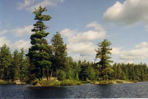
The east side of Algonquin Park is quite different in appearance to the west. While the west side is dominated by hardwood forests and thick vegetation, conifers predominate to the east and the forests have a more open feel. The rugged pine-and-granite scenery of the east side resembles regions of the Canadian shield north of the park.
Most canoeists take two or three days to complete a trip through the Barron Canyon, starting at Achray Station, camping somewhere between Stratton Lake and Opalescent Lake en route, and then continuing on down the canyon to Squirrel Rapids. A car shuttle is then used to complete the trip back to Achray. It is important to remember that the distance along the dusty gravel road from Squirrel Rapids to Achray is 20 km, and would make a decidedly unpleasant walk. It may be possible to arrange a shuttle with the Algonquin Portage Store . On a summer weekend there is a good chance of begging a ride back to Achray from the Squirrel Rapids parking lot, but it is not advisable to rely on this. The only other reasonable possibility for completing this trip with one vehicle is to leave a mountain bike at Squirrel Rapids, and then bicycle back to Achray.
Since many of the portages above the Barron canyon are steep and rock-strewn, portaging a full set of camping gear from Grand Lake to the bottom of Brigham Chute can be an exhausting undertaking. An alternative approach is to paddle up the canyon from Squirrel Rapids. This can be done as a long day trip from the Ottawa area, or by camping overnight in the Achray area, and then driving to Squirrel Rapids in the morning. It is also possible to camp at one of several wilderness sites between Squirrel Rapids and the canyon, all of which are reached with a minimum of portaging. Strong canoeists can complete the route from Achray to Squirrel Rapids as a long day trip, avoiding the need to portage camping gear.
|
|
|
|
Until 1994 the CN main line ran along the shores of Stratton and
Grand Lakes. The line has now been abandonned, and the tracks and ties
removed. There is a chance the right-of-way will eventually be
converted into a trail for hiking and cross-country skiing. In some
ways I miss the CN freights rumbling through this area. They could
hardly be considered part of a wilderness experience, but they were a
reminder of the importance of the rail line across the Shield in
Canadian history. I won't regret never again being awakended by the
whistle and lights of a
freight train at 4AM, as we were one night when camped very close to
the tracks in the overflow campground at Achray!
The north end of Grand Lake is relatively uninteresting, and has few campsites. A high-voltage Ontario Hydro transmission line which cuts a swath across the portage trail leading to Clemow Lake does little to increase the attractiveness of this area.
 |
|
|
 |
|
|
A walk up the 90 m portage trail to the west of the falls leads to another small basin formed in a huge granite slab worn perfectly smooth by the water.
 |
|
|
 |
|
|
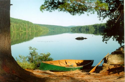
Stratton Lake is long and relatively uninteresting, but has several superb campsites at the south end of its eastern shore.
 |
|
|
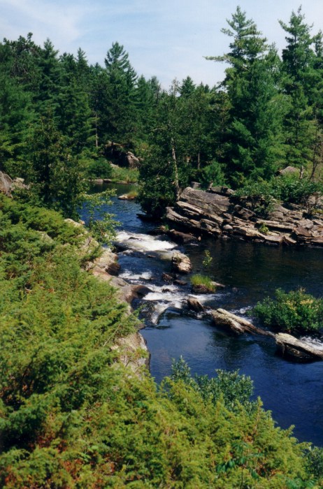
The Barron River exits Stratton Lake via a long inlet branching to the east. The river plunges through a drop of over 50 m in a sweeping curve of rapids and low waterfalls interspersed with small pools. The pools make popular swimming holes in the summer. A superb view of this intricate set of falls is available by paddling to the head of the inlet and scrambling up the granite outcrop that borders the lake. This viewpoint can also be reached by a 10 km long hiking trail starting at Achray Station.
 |
|
|
 |
|
|
 |
|
|
It is not possible to portage around the falls, so the canoe route to the Barron Canyon passes through St. Andrew's Lake to the south. The 45 m portage to St. Andrew's Lake is reached via a shallow, meandering stream, in which care must be taken to avoid submerged rocks and logs. During spring runoff it may be possible to bypass the portage and run the short, straight rapid connecting the two lakes.
There are several good campsites on the western shore of St. Andrew's Lake adjacent to the portage from Stratton Lake. A long, high cliff forms the bulk of the eastern shore.
Paralleling the Barron River, the route to the Barron Canyon exits St. Andrew's Lake at the north end. The 550 m portage trail leads past an extended falls and rapids down to Highfalls Lake.
The portage trail from St. Andrew's Lake ends in a steep, tortuous landing at Highfalls Lake. Threading a canoe through the maze of trees above this landing can be trying. Highfalls Lake itself is shallow for most of its length, requiring care in picking a route. The lake is dotted with small granite islands that make good stopovers for swimming.
 |
|
|
At the north end of the lake the route to the Barron Canyon splits into two branches. The shorter route takes a 300 m portage to Ooze Lake. The alternative route follows the Barron River as it arches north and east. This second route requires six short portages at typical summer water levels. In the spring it may be possible for experienced whitewater canoeists to run a few of these rapids, but the Ooze Lake route is still the recommended choice.
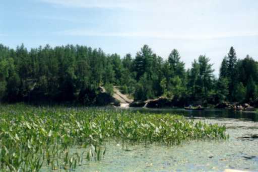
Ooze Lake is really a short section of bog interrupting the portage trail between Highfalls Lake and Opalescent Lake. The lake is remarkable for its enormous amount of decaying organic debris. Huge mats of vegetation float on its surface, suspended by gas bubbles produced in the anaerobic decay below.
A level 700 m portage leads from Ooze Lake to Opalescent Lake. The two lakes could hardly be more different. Opalescent's water is clear and clean, and the rocky point at the center of the western shore of the lake makes a good spot for swimming.
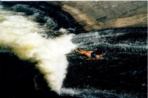
From Opalescent Lake a flat 700 m portage leads to Brigham Lake. This lake is also accessible by car from the Achray Road, providing an alternative means of reaching the canyon as a day trip. The rapids at the east end of the lake are relatively easy to run when water levels are high, or can be bypassed via a 100 m portage. The following 440 m portage leads past Brigham Chute, one of the most magnificent waterfalls in the park.
 |
|
|
 |
|
|
The 400 m portage trail bypassing Brigham Chute ends in a steep, awkward landing at a quiet pool above the Barron Canyon. On summer weekends the landing is frequently clogged with canoes and gear of overnight campers arriving at the canyon from the lakes to the west, and day trippers hiking to the falls. Out of courtesy to others, gear should be cached well off the trail if you are stopping at the portage.
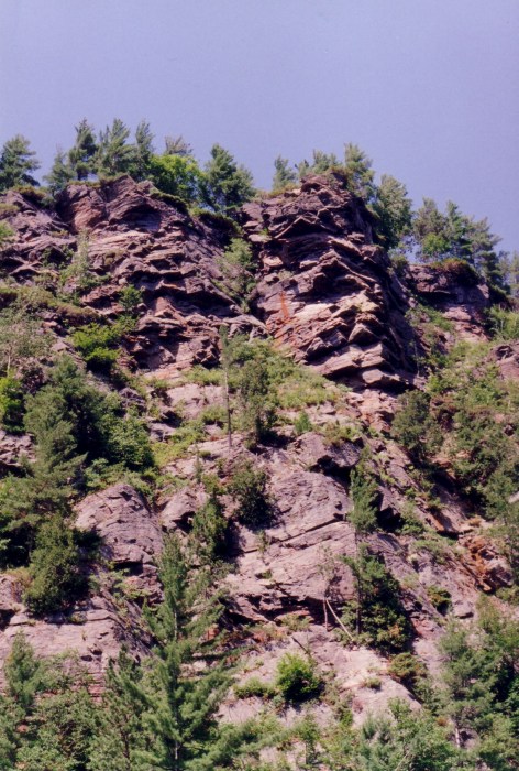
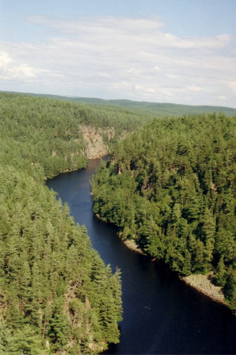
A short distance below the landing the walls of the canyon start to rise on both sides of the river. The banks here are lined with a jumble of truck-sized boulders, some of which are level enough to make good lunch stopovers. The 2 km long canyon itself is awe-inspiring. In sections the 100 m high walls rise vertically from the dark, peaty water, and one can see places where the hiking trail skirting the cliff edge is severely undercut. Swallows nest under the overhangs in the spring, and until mid-summer are seen darting about the canyon. This is an ideal place to simply lie back and let the canoe drift with the gentle current while watching the vista above.
 |
|
|
 |
|
|
 |
|
|
Below the canyon the river's shores open into marshland. Blue heron are very common in this area. After about a 2 km paddle from the canyon a 400 m portage around an unnamed but unrunnable rapid is reached. Once again poison ivy is prevalent along the portage trail. The parking lot at the Squirrel Rapids bridge is reached just below the portage.
| Back to Virtual Algonquin main page | Last revision August 2004 |
Copyright 2004 Garry Tarr and Jo-Ann Holden